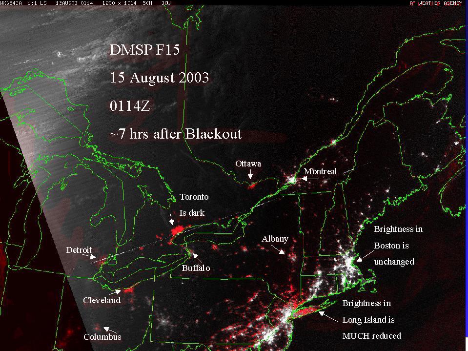
You're showing too much red in Pennsylvania. We didn't loose power, except in the NW (Erie, PA) corner of the state. Certainly not down in the SE, where you've got a lot of red.
You might notice that the red is on the outskirts of bright areas... (I was noticing the same thing). It's also more pink than red -- indicating that there's still some light there.
Perhaps it's cloud cover obscuring all but the brightest lights.. (either that, or people turned down their lights to help out with the emergency).
The way that I did this was that I took the post-blackout image , and made a reasonable effort to register it to the pre-blackout image . (I had to scale up one of the images by about 3 pixels (~0.3%) to get them to fit properly). I then subtracted the post-blackout image from the pre-blackout image.
Having that difference, I then turned white to bright red, and then added that back in to the post-blackout image (all in GIMP). The result was final blackout image.
Given the way that I did this, any sort of darkening in the post-blackout image (such as from cloud cover) would probably show up as the sort of pink fringing that you see in PA.
BTW: Both the pre and post images came from the NOAA